Get a year of super-useful advice
Who to book with, how to get the best deals plus inspiring destination ideas from the experts, for only £49 for the year.
Join Which? Travel
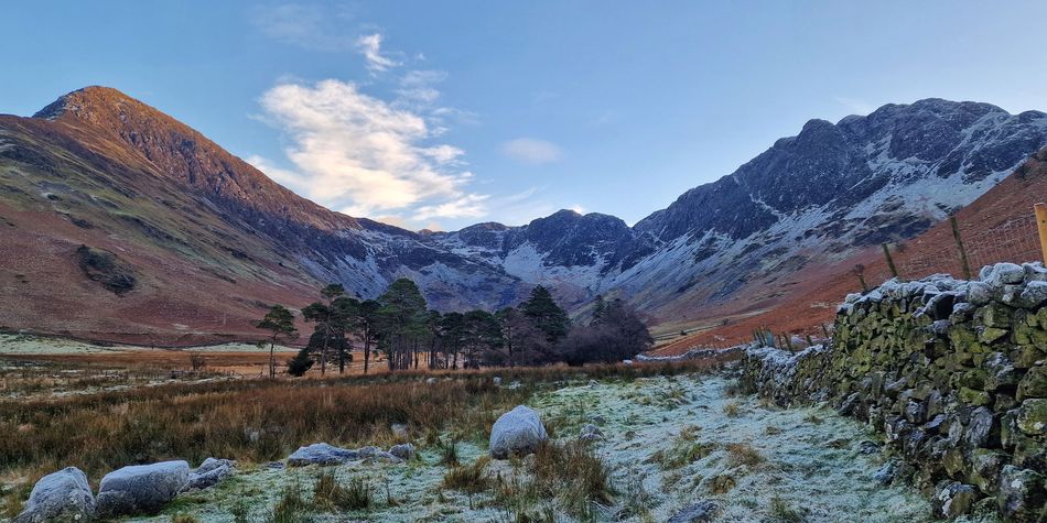
From the eastern edge of Coventry, where red-brick houses give way to a children's play area called Juniper Park, you can walk straight out into the English countryside.
After about an hour of skirting farmland, climbing stiles and admiring the views across Warwickshire, you'll come to Millison's Wood, a remnant of the ancient Arden Forest, which once covered much of the West Midlands. Or at least you used to be able to.
I'm with Jayne O'Toole, who's been walking this path since she was a child. She took her children and then grandchildren to play in the woods. However, the path is now overgrown and uncared for. We push through long strands of dry grass. A tree has toppled and been left where it fell, bent double over the right of way.
But that's not the real problem. After walking for 10 minutes we're faced with a six-foot metal fence. 'I emailed Coventry City Council and it replied that it was an illegal blockage,' Jayne says. 'A few weeks later, I emailed again and they said it was legal – but temporary.' That was more than three years ago. The fence is to prevent access to a planned development of around 3,500 houses, but work has barely started.
This article first appeared in Which? Travel magazine. We don't accept freebies from travel companies, airlines or hotels, so you can be sure our investigations, recommendations and reviews are completely honest.
Who to book with, how to get the best deals plus inspiring destination ideas from the experts, for only £49 for the year.
Join Which? TravelWe eventually discovered that the first developer had gone bust, before the development was taken over by Lagan Homes. The company said: 'All work carried out by Lagan Homes in the area has been in accordance with planning consents and any conditions stipulated by the council.' It added that Coventry City Council was responsible for the right of way and ensuring a suitable diversion. Three years after the initial complaints, and only after Which? involvement, Coventry City Council told us on 16 July that it is 'in the process of scheduling an inspection' to make sure any changes to the footpath are legal. We asked the council in September and in October whether that inspection has happened, but it did not reply.
This is just the tip of the iceberg across the country.
The history of access to public land differs across UK nations, but in England and Wales, almost all public footpaths are the responsibility of councils. In theory, they also have strong legal powers to protect your right of way – but do they have the resources or the will?
We asked 141 local councils and national parks in England and Wales how many blocked footpaths they had at the end of last year. Only 83 responded with data, but between them, they said it was 32,120. That's higher than the figure the BBC found when it did the same research for 2023.
The true number will be much, much higher. Coventry City Council was one of many to tell us it doesn't have a record of how many footpaths are blocked. One council refused our request because it said it would take 750 hours to sift through all its reports.

'Some of these paths date back to the very oldest Roman roads, or even before that,' says Sophie Reindorp of the Ramblers. The Ramblers was instrumental in pressuring the government to introduce the National Parks and Access to the Countryside Act 1949, described as 'a people's charter for the open air'. 'When you walk them, you have a sense of connection to our ancestors,' Sophie explains. 'There's a freedom in setting out from your doorstep and walking for miles across open countryside.'
When we surveyed walkers from the Ramblers and volunteer walk leaders from HF Holidays, 52% said they'd come across routes that had deliberately been obstructed. 'It is a huge problem,' Sophie says. 'If a path is overgrown, you're allowed to take secateurs with you and clear as much of it as you need to get by.' Unfortunately, she says, that doesn't work if the obstacle is a metal fence, rather than a bramble bush.
The situation is even worse for thousands of long-established footpaths that have never been added to the map by councils. They have little legal protection. Every year, the Ramblers request Definitive Map Modification Orders (DMMOs) – which give paths legal status. But there's a backlog of 8,169, according to another freedom of information request. Nine of the 10 worst councils have seen their backlog grow in the year since then. The worst council – Lincolnshire – has increased the number of DMMO applications pending from 458 to 544.
In this country, we still have a wonderful network of mostly well-maintained walking routes, but it didn't happen by accident. It was hard-won through a hundred years of protest and petition. At the time the National Parks and Access to the Countryside Act was introduced, MP Lewis Silken said people were 'fettered, deprived of their powers of access and facilities needed to make holidays enjoyable. With it the countryside is theirs to preserve, to cherish, to enjoy and to make their own.' Ordinary people stood up for their right to roam in the 1930s, and they need to again.
The best way to defend our footpaths is to enjoy them. If something's in the way on your next walk and a pair of secateurs won't do the trick, report it. Google ‘Public Rights of Way’ and your council name to find the email address or online form. Then give it the path number and/or Ordnance Survey Map reference if you can, and details of the blockage. You can also contact your local Ramblers Group Footpath Officer for assistance with blockages by searching online for the local Group's website. Which? Recommended walking holidays Provider HF Holidays has the similar Pathways Fund, which puts up signposts and improves footpaths.
If you think a footpath isn't being protected by the council, first check that it's listed as a public right of way. Every council has what's known as the 'Definitive Map' – usually online but also at the council's head office – where all routes are marked. If it's not marked, the Ramblers 'Don't Lose Your Way' campaign will show you how to apply to add it to the map.